Berwick North and South Local Amenities
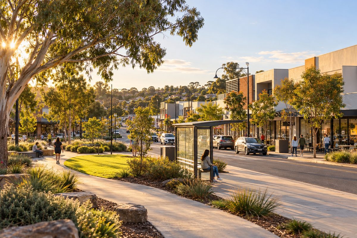
North Berwick gives you the old village, heritage streets and the railway station within easy reach, while south Berwick gives you newer estates, bigger car-based shopping, the university campus and the hospital. The split is real, but it is uneven. Some of the amenities people call "Berwick" sit in neighbouring suburbs, and the hardest part of daily life is often crossing the transport corridor between the two halves. This guide compares both sides by what you actually use each week, so you can choose the half that fits your routine.
For broader background on the suburb, start with the Berwick Village Notes local guide.
Where does the north and south split actually fall?
Berwick, Victoria is a suburb in Melbourne's south-east, managed by the City of Casey. Locals rarely use a formal boundary. Instead, they read the suburb through a band of transport that runs east to west across it.
That band has two layers. The Princes Highway carries local traffic past the village area. Further south, the railway line and the Monash Freeway form a second barrier. When people say "north Berwick", they usually mean the older, hillier streets around the village. When they say "south Berwick", they mean the estates built in recent decades on flatter land toward Clyde Road and beyond.
Think of it as a mind map. The big picture is one suburb with two personalities. The next layer is the corridor that separates them. The detail is which amenities land on each side, and how easily you can reach the other.
What does the northern side do best?
The north is where Berwick's character lives. High Street holds the village strip, with cafes, small shops, pubs and services set along a walkable main street. Older homes, mature trees and larger blocks give the area its established feel.
Green space is a strong point. Wilson Botanic Park, a former quarry turned botanic garden run by the City of Casey, offers walking paths, lakes and picnic areas. It suits people who want a quiet walk without driving across the region.
Health care is also close for northern residents. St John of God Berwick Hospital, a private hospital, sits near the village. Medical clinics and allied health practices cluster around High Street.
What the north lacks is a large, all-in-one supermarket complex inside the village itself. Weekly shopping often means driving to a bigger centre. The village works well for coffee, small errands and dinners out. It works less well for a big trolley run.
Who the north tends to suit
- People who value walking to cafes and village shops.
- Commuters who want the railway station within a short trip.
What does the southern side do best?
South Berwick is built around the car and around families. Estates such as Kambrya and the streets around Clyde Road have newer homes, wider roads and local parks placed inside each development.
Shopping is more practical here. Eden Rise on O'Shea Road is a neighbourhood shopping center (or shopping centre, as Australians spell it) with a supermarket and everyday stores, and it has a large car park. For residents in the southern estates, it handles most weekly needs.
The south also holds two big institutions. Casey Hospital, a public hospital, sits on the southern side near Clyde Road. The Federation University Australia, Berwick campus is on Clyde Road as well. Both bring jobs and services close to southern homes.
The trade-off is character and walkability. Many southern streets were designed for driving. A trip to a cafe often starts with a car, even when the distance looks short on a map.
Who the south tends to suit
- Families who want a newer home and a big weekly shop nearby.
- Students or staff linked to the university campus or Casey Hospital.
Which amenities shape Berwick life from outside the suburb?
Many guides list amenities as if they all sit in Berwick. They do not. Several of the places residents use most are in nearby suburbs, and their location changes which half of Berwick is more convenient.
Westfield Fountain Gate is the clearest example. It is in Narre Warren, west of Berwick, and is one of the largest shopping centres in Australia. Residents on the western edge of both halves reach it quickly. Residents in east Berwick face a longer drive. Its pull matters more than any single shop inside Berwick.
Casey Fields is another. This large sports precinct is in Cranbourne East, south-west of Berwick. Families with children in local football, cricket or athletics often travel there. South Berwick has the easier run to it.
Pakenham, Victoria sits east along the same rail and road corridor. It offers its own larger shops and services. Residents in east Berwick sometimes find Pakenham closer than Fountain Gate for big errands.
The lesson is simple. Map your weekly destinations first, including the ones outside the suburb. The right half of Berwick is the one closest to where you actually go.
How does transport change which side works for you?
Transport is the amenity that decides most other amenities. Berwick has one train station and one major freeway route, and both sit in the middle band.
The train
Berwick railway station, Melbourne's stop for the suburb on the Pakenham line, sits near the old village area. Trains run west toward the city through Narre Warren and Dandenong, and east toward Pakenham. Northern residents can often reach the station on foot or by a short drive. Southern residents usually drive, cycle or catch a bus, and parking near the station fills early on weekdays.
If you plan to commute by train, check how you will reach the station at 7:30 on a weekday, not on a quiet Sunday. That single test tells you more than any distance on a map.
The freeway
The Monash Freeway runs along Berwick's southern side. Southern residents reach it quickly through interchanges such as Clyde Road. Northern residents must cross the corridor first, which adds time in peak traffic.
This creates a neat mirror. The north is closer to the train. The south is closer to the freeway. If you drive to work, the south often wins. If you take the train, the north often wins.
Getting between the halves
Crossing from north to south means passing the rail line and the freeway. A small number of roads do this, with Clyde Road and Berwick-Cranbourne Road among the main links. In busy periods, these crossing points slow everyone down. A trip that takes ten minutes at midday can take much longer at school pick-up time.
How do schools spread across the two halves?
Schools are split, and the split matters because government school zones follow your address. Always check the current zone on the Victorian Government's Find My School website before you rent or buy.
Berwick College, a government secondary school, sits on the northern side. Kambrya College, also a government secondary school, serves the southern estates around Kambrya. A family that wants a particular government school should choose its half of Berwick around that zone, not the other way round.
Beaconhills College is an independent co-educational school with a Berwick campus and a Pakenham campus. Because enrolment is not zoned, families travel to it from both halves. Bus routes and drop-off traffic then become part of the decision.
For tertiary study, the Federation University Australia, Berwick campus gives southern residents a local option. Northern residents can still reach it, but they cross the corridor to get there.
What do most amenity guides get wrong?
The common mistake is treating Berwick as one evenly served suburb. In practice, three points are often missed or misread.
First, the corridor is the real boundary. A home 2 kilometres from Casey Hospital on the wrong side of the rail line can feel further away than a home 4 kilometres away on the same side.
Second, the biggest shops are outside Berwick. A guide that praises Berwick's shopping without naming Westfield Fountain Gate leaves out the place many residents use most.
Third, "walkable" depends on your street. Some southern estates have good paths and local parks. Some northern streets are steep. Hills matter if you walk with a pram or cycle to the station.
How should you decide between north and south?
Start with your fixed weekly trips, then let them pick the side. The examples below are hypothetical. They show how the comparison plays out, not stories from real residents.
Hypothetical example: the train commuter
Imagine a person who works in the city five days a week and does not want to drive. A northern home near the village lets them walk or take a short drive to Berwick station. Living in the south would add a bus or car leg each morning. For this person, the north is the clear choice.
Hypothetical example: the family that drives
Now imagine a family with two school-age children, one parent driving to Dandenong for work and weekend sport at Casey Fields. A home in the south puts them near the freeway, near Eden Rise for groceries and closer to the sports precinct. If the children attend Kambrya College, the school run stays on the same side too. For this family, the south saves time every day.
Hypothetical example: the mixed household
Some households have one train commuter and one driver. In that case, look at homes close to the corridor, near a main crossing such as Clyde Road. You give up some village charm and some estate space, but neither person faces a long trip to their transport.
What should you do before choosing a side?
Use these steps to test both halves against your real routine.
- List every place you visit each week, including spots outside Berwick such as Westfield Fountain Gate, Casey Fields or Pakenham.
- Check government school zones on Find My School for any address you are considering.
- Drive or ride to Berwick station during a weekday morning peak and note how long parking takes.
- Drive across the corridor at school pick-up time to see how long north to south trips really take.
- Walk the streets around a potential home to judge hills, footpaths and distance to the nearest park.
- Read the City of Casey website for upcoming works, parks and community facilities near your chosen area.
The single takeaway: choose the half of Berwick that sits on the same side of the rail and freeway corridor as the places you go most often, because crossing that line is the cost you will pay every day.
For more local detail on streets, parks and services, browse the Berwick Village Notes guides.