Clyde North Near Berwick Local Guide
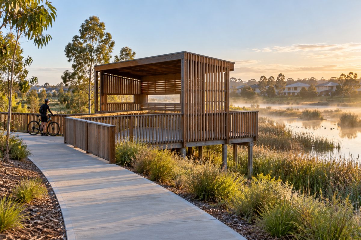
Clyde North is a new-estate suburb just south of Berwick, and most of daily life there runs along two roads: Clyde Road heading north into Berwick and Thompson Road heading west towards Cranbourne. If you understand those two roads, you understand how the suburb works. The homes are new, the streets are quiet, and the bigger services sit a short drive away in older suburbs. This guide explains that setup so you can plan a move or a visit with clear expectations.
For more on the town centre this suburb leans on, see the main Berwick Village Notes guide.
Where does Clyde North sit compared with Berwick?
Clyde North sits directly south of Berwick, Victoria. Both suburbs are part of the City of Casey, the council that runs local roads, parks, bins and planning for the area. Clyde North shares the 3978 postal code with neighbouring Clyde, so an address with that postal code does not always mean the same suburb. Check the suburb name as well as the number when you look at listings or book deliveries.
The suburb is roughly 45 to 50 kilometres south-east of the Melbourne central business district. That distance matters more than it sounds. It shapes how long a city commute takes, and it explains why many residents treat Berwick as their nearest "proper" town centre rather than heading into the city for everyday things.
Why the two suburbs feel so different
Berwick is an older township with a main street, established trees and heritage buildings. Clyde North was mostly farmland until the 2010s. Most of it is now built as one housing estate after another, each with its own name, entry signs and parks. You can drive from a Berwick street lined with old oaks to a Clyde North street where the nature strips were planted last year, all within about ten minutes.
How do the estates shape life in Clyde North?
The estate you choose decides a lot about your daily routine. Each housing estate in Clyde North was planned by a developer with its own mix of parks, walking paths and, in some cases, a small local shopping strip. Well-known names include Berwick Waters, Selandra Rise and Highgrove.
One small point trips people up online. Searching for Highgrove often brings up Highgrove, California, a community in the United States. The Highgrove most people mean in this area is the estate in Clyde North. Add "Clyde North" or "Victoria" to your search and you will get the right results.
What estate life means in practice
- Parks arrive in stages. Developers often open playgrounds and wetlands as each new section is finished. A park shown on a sales plan may not exist yet.
- Street trees take years to grow. Summer shade is limited in the newer parts, so walks and school runs can feel hot.
- Building works continue nearby. If your street backs onto an unfinished stage, expect trucks and noise for a while.
Here is a hypothetical example to show how this plays out. Picture a family that buys in a newly released stage because a big park is drawn right next to their lot. They move in and find a fenced paddock. The park opens two years later. Nothing was hidden, but the timing caught them out. Asking the developer for the expected delivery date of each facility avoids that surprise.
Which roads matter most for getting around?
Two roads do most of the work. Clyde Road runs north from Clyde North straight into Berwick. Thompson Road, Melbourne runs east to west across the suburb and links it towards Cranbourne North and Cranbourne. Both act as an arterial road, which means they carry heavy traffic between suburbs rather than serving quiet local streets.
Clyde Road: your link to Berwick and the freeway
Head north on Clyde Road and you pass through Berwick and reach the M1. Heading west on the M1 takes you onto the Monash Freeway, the main road link towards the Melbourne central business district. In clear traffic the drive into the city is long but simple. In peak hour it can stretch well past an hour, because the Monash Freeway is one of Melbourne's busiest roads.
Clyde Road also takes you past the Federation University Australia, Berwick campus, which sits on Clyde Road in Berwick. For students living in Clyde North, that makes the campus one of the closest tertiary options. Check the university's website for which courses are currently taught there, since offerings at regional and outer campuses can change.
Thompson Road: your link to Cranbourne
Thompson Road is the main east to west road through the suburb. It has been the focus of road upgrades as the population has grown, and works on roads like this can change lane layouts and travel times for months at a time. For current works, check the City of Casey and Victorian Government transport updates before you plan around a particular route.
Going west along Thompson Road puts Cranbourne, Victoria within easy reach. Many Clyde North residents split their errands between Berwick and Cranbourne depending on which side of the suburb they live on.
How do you get to the train from Clyde North?
Clyde North has no train station of its own. Residents drive or catch a bus to a nearby station. The two main choices are Berwick railway station, Melbourne, on the Pakenham line, and Cranbourne station, at the end of the Cranbourne line.
Which one suits you depends on where you live in the suburb. Here is a simple rule:
- Northern Clyde North: Berwick railway station is usually the shorter drive, straight up Clyde Road.
- Western Clyde North: Cranbourne station is often quicker to reach along Thompson Road.
Both lines run into the Melbourne central business district. Car parks at outer stations fill early on weekdays. If you plan to park and ride, aim to arrive before the morning rush or look at a feeder bus instead. Check the Public Transport Victoria journey planner for current bus routes, because new estates often get routes added or changed as streets open.
A hypothetical commute comparison
Imagine two neighbours who both work in the city. One drives to Berwick railway station and finds the car park full at 8:15 am, then loses time circling for a spot. The other leaves ten minutes earlier and parks without trouble. Same suburb, same train line, very different mornings. In outer suburbs like this, the time you leave matters as much as the route you take.
Where do Clyde North residents shop?
For quick errands, residents use the smaller local centres built inside or beside the estates. These usually have a supermarket and a handful of food and service shops. For a bigger trip, people drive to a larger shopping center in a nearby suburb.
The larger options include:
- Berwick's main street and village shops, reached via Clyde Road, for cafes, local services and a town-centre feel.
- Fountain Gate in Narre Warren, one of the largest shopping centres in Melbourne's south-east, a short freeway drive away.
- Cranbourne Park in Cranbourne, reached along Thompson Road and other western routes.
What most guides miss is that the local centres change fast. A new estate may open with one small shop and grow into a full centre a few years later. Check the current tenant list of your nearest centre rather than relying on an older review or map.
How do schools work for families in Clyde North?
Government primary schools have been built across Clyde North as the estates filled up. Secondary school options are spread more widely, and some families travel into Berwick, Cranbourne or neighbouring suburbs for high school. There is also a mix of Catholic and independent schools in and around the area.
The most useful step is to check school zones before you buy or rent. In Victoria, government school zones are set by the Department of Education and can be checked on the Find My School website. Zones in growth areas get redrawn when new schools open. A street inside one secondary school zone this year may be moved into a different zone later.
Why school zones catch people out
Think about a hypothetical family who chooses a house because it sits in the zone for a well-regarded secondary school. A year after they move in, a new school opens closer to them and the zones shift. Their younger child now falls into the new zone. This happens often in fast-growing suburbs. It is not a reason to avoid the area, but it is a reason to read the zone notes and ask the school directly about planned changes.
What do most guides get wrong about Clyde North?
Most guides describe Clyde North as a standalone suburb. In daily life it works more like Berwick's southern neighbourhood. Residents sleep and play in Clyde North, but they often work, study, catch trains and shop in Berwick or Cranbourne. Treating it as a self-contained place leads to the wrong expectations.
Here are three common mistakes and the reality behind each:
- Assuming everything is walkable. Parks and local shops may be close, but trains, larger shopping centres and many secondary schools need a car or bus.
- Judging travel times on a weekend. A Saturday drive along Clyde Road can feel quick. A weekday peak-hour drive on the same road is far slower.
- Trusting sales plans as finished facts. Planned parks, shops and schools are real goals, but delivery dates move.
Who does Clyde North suit best?
Clyde North suits people who want a newer home with a backyard and are happy to drive for bigger services. Young families often like the parks, the playgrounds and the newer primary schools. People who need to be in the Melbourne central business district five days a week should test the commute before committing, because the distance is real.
It suits people less well if they want a walkable main street at their front door, or if they do not drive. For that lifestyle, older parts of Berwick, Victoria, closer to the station and High Street, are a better match.
How Clyde North compares with living in Berwick
- Homes: Clyde North offers mostly new builds on newer lots. Berwick offers a mix of older houses and some new infill.
- Transport: Berwick has its own railway station. Clyde North relies on driving or buses to reach one.
- Character: Berwick has an established town centre. Clyde North has estate parks and smaller local shopping hubs.
What should you do before moving or visiting?
The single most useful thing you can do is drive the key routes at the times you will actually use them. A weekday morning run up Clyde Road to Berwick railway station, and a run along Thompson Road towards Cranbourne, will tell you more than any listing.
Then work through these steps:
- Confirm the suburb and postal code. Check that an address in 3978 is in Clyde North and not Clyde.
- Check school zones. Use the Find My School website and ask schools about any planned zone changes.
- Ask about estate timelines. Get expected opening dates for nearby parks, shops and community centres in writing.
- Test the commute in peak hour. Drive or catch the train at your real work times, including the Monash Freeway if you will use it.
- Look up City of Casey plans. The council website lists planned roads, parks and community facilities in the area.
- Visit your nearest shopping center. See what is actually open now, not what is promised later.
Do the peak-hour drive first. It is the quickest way to learn whether Clyde North's link to Berwick fits your week. For more about life in the town centre itself, explore Berwick Village Notes.