Berwick Local History Landmarks
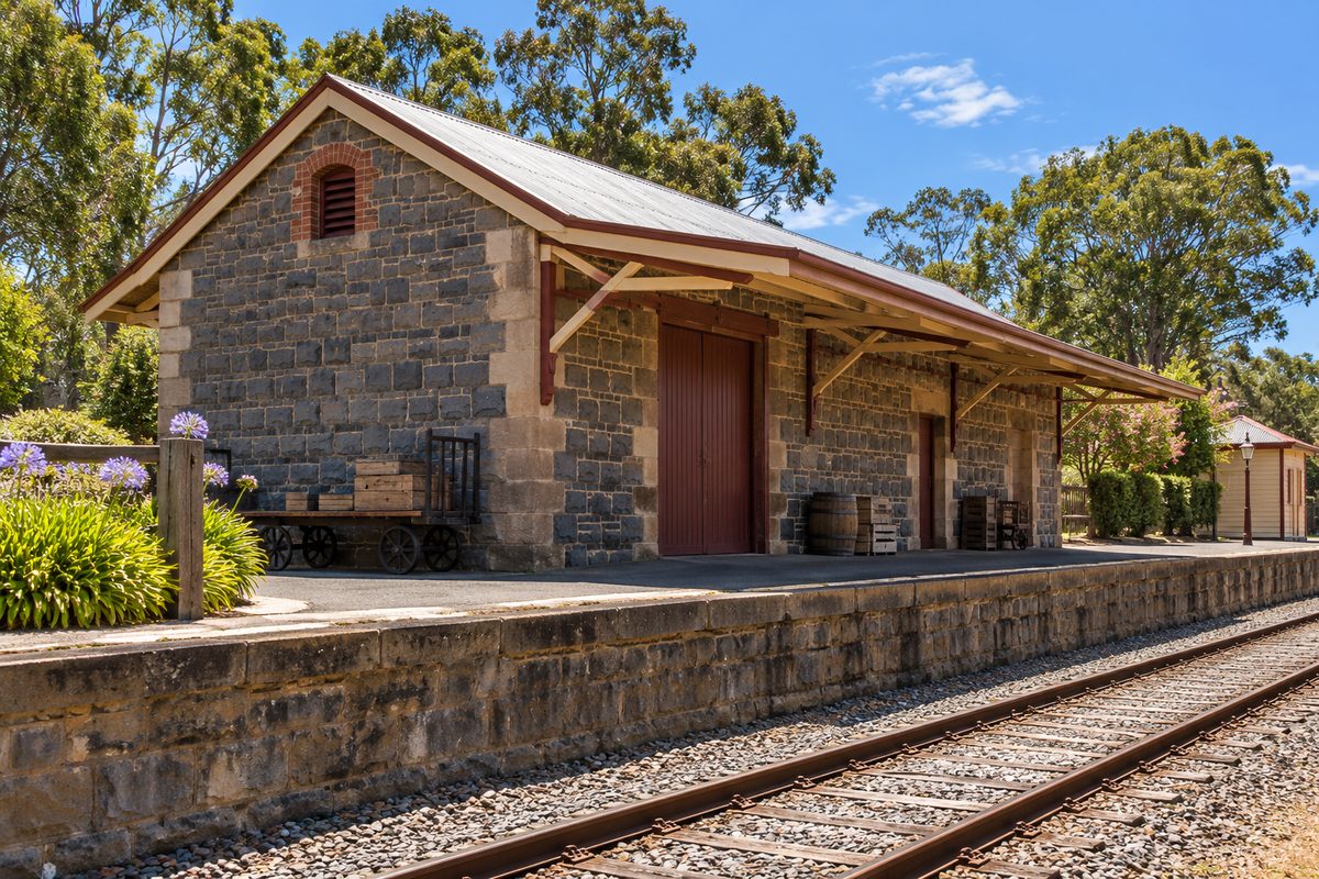
Most of Berwick's history landmarks sit within a short walk of High Street, and they make the most sense when you read them as one story: a 19th century country township that slowly became a Melbourne suburb. Seen one at a time, an old shopfront or a stone wall can feel like a random leftover. Seen together, they show how the town was laid out, how people got here and what they built once they arrived.
This guide covers the main places in Berwick, Victoria, what each one tells you, and how to check whether a building you like is actually protected. It also points out a few things most local history write-ups miss. For more on the area, see the Berwick Village Notes home page.
Why does a Melbourne suburb share its name with a town in England?
Berwick takes its name from Berwick-upon-Tweed, a market town on the border of England and Scotland. The name is usually credited to Captain Robert Gardiner, one of the early squatters in the district, who came from that part of the world.
This matters more than it sounds. Search for "Berwick history" and you will get pages about medieval walls, border wars and a town that changed hands between England and Scotland many times. None of that happened here. When you research local landmarks, add "Victoria" or "Casey" to every search. It saves a lot of wasted reading.
The name also tells you who shaped the early town. Many settlers in this part of Port Phillip came from Britain, and they gave places names from home. The street grid and the style of the older buildings reflect that same background.
What does High Street tell you about the Victorian era town?
High Street is the backbone of old Berwick. The township grew up along the main road east from Melbourne toward Gippsland, so travellers passed straight through it. That is why the oldest commercial buildings line up along one street instead of spreading out in blocks.
Walk it slowly and look above the shop awnings. Modern signs and glass sit at street level, but the upper parts of many buildings still show Victorian era and early 20th century details. Look for parapets, brick patterns and old painted lettering. The ground floor tells you what the building is now. The top floor tells you what it was.
The Mechanics' institute
Berwick's Mechanics' institute is one of the clearest signs that this was once a self-contained country town. Mechanics' institutes spread through Victoria in the 1800s. They gave working people a place to borrow books, attend lectures and hold meetings at a time when public libraries were rare outside the city.
Berwick's institute still runs as a community library and hall, managed by volunteers. That makes it unusual. Many towns kept the building but lost the library. Here you can walk in and see the original purpose still working. Check its current opening hours before you go, as volunteer-run places often keep limited days.
The old inn and the shopfronts
The Berwick Inn is the other High Street anchor most people know. Inns came first in coaching towns because travellers needed food, a bed and a place to rest horses. The pub's long life on the same corner shows how central the road was to the town's early economy.
The war memorial and the older churches near the village centre fill in the rest of the picture. Together they show a town that had money, faith and a strong local identity well before the suburbs reached it.
How did the train station change Berwick?
Berwick railway station, Melbourne, opened in the late 1870s when the railway line to Gippsland pushed east through the district. Today it sits on the Pakenham line, but its first job was linking farms and small towns to the city.
The train station shifted the town's centre of gravity. Before the railway, the road was everything. After it, people and goods could move to Melbourne far faster, and dairy and orchard produce found new markets. Over the 20th century, the same line made it possible to live in Berwick and work in the city. That is the real reason the quiet township became a commuter suburb.
Here is a point most guides skip. The station is not right on High Street. It sits a short distance south of the old village centre. That gap is a clue in itself. The township was already set before the railway came, so the line had to fit around it. If you walk from the station to High Street, you are walking from the 1870s back into the 1850s and 1860s.
Which landmarks sit outside the village centre?
Some of Berwick's best history is in the land, not in buildings. These places need a car or a longer walk, but they round out the story.
Wilson Botanic Park
Wilson Botanic Park is a former quarry that was turned into public gardens. The old quarry walls and lakes are still part of the design, so you can see the industrial past and the garden side by side. It shows a common pattern in Melbourne's growth suburbs: land that was once worked for stone or farming gets a second life as open space.
Look at the steep rock faces around the water. Those are the quarry's leftovers, and they explain why the park has such sharp changes in level compared with the flat streets around it.
Edrington and the Casey name
Edrington, on the edge of Berwick, was the home of Richard Casey, who served as Governor-General of Australia. The City of Casey, the council that now covers Berwick, is named after him. Most residents use the council name every week without knowing it points to a house in their own suburb. The property is now part of a retirement village, so treat it as a place to know about rather than a place to wander through.
Cardinia Creek
Cardinia Creek runs along the eastern side of Berwick. It shaped where people could farm and build, and today it forms much of the boundary between the City of Casey and the Shire of Cardinia. The creek corridor is a good reminder that local boundaries often follow water, not neat lines on a map.
Harkaway, Victoria
Harkaway, Victoria, sits in the hills just north of Berwick. It was settled in part by German immigrant families in the mid-1800s, and its rural roads and old cemetery still carry that history. A short drive up from Berwick shows you what much of the district looked like before housing estates arrived: small farms, rolling paddocks and long views back toward the bay.
How do you tell if a building is actually protected?
Look it up. Do not assume an old building is protected because it looks old, or that a plain building is unprotected because it looks ordinary.
Victoria uses two main levels of protection, and they work differently:
- Victorian Heritage Register: This is the state list. It covers places of significance to Victoria as a whole. Changes to these places need a permit from Heritage Victoria.
- Heritage Overlay: This is the local layer, set through the council's planning scheme. In Berwick, that means the City of Casey. A Heritage Overlay can cover a single building or a whole precinct, such as a run of shops.
Most of Berwick's protected places fall under the local Heritage Overlay rather than the state register. That catches people out. A building can be well protected at council level without appearing on any state list.
To check a specific property, search the Victorian Heritage Database online. It brings together state and local listings in one place. For planning details, check the City of Casey planning scheme maps, which show where each overlay applies.
Why this matters for you
Take a hypothetical example. Say you are thinking of buying an old weatherboard house near the village centre with plans to extend it. If it sits under a Heritage Overlay, you will likely need a planning permit for external changes, and some designs may not be approved. Knowing that before you buy saves money and stress. The same check helps if you simply want to know which buildings on your walk have formal recognition.
What do most local history guides get wrong?
Three common mistakes trip up readers, and each one is easy to fix.
They treat council boundaries as fixed. They are not. Berwick was once the centre of its own shire. The 1994 council changes created the City of Casey and the Shire of Cardinia, and older records often use names that no longer exist. When you read an old newspaper or map, the council named may not match today's. Expect that, and you will find records faster.
They only list buildings. Some of the strongest evidence of Berwick's past is in the landscape. The quarry walls at Wilson Botanic Park, the line of Cardinia Creek and the farm roads of Harkaway tell you as much as any facade.
They ignore the order things happened. The road came first, then the inn and shops, then the institute, then the railway, then the suburbs. If you visit landmarks in that order, the story builds in your head. Jump around and it stays a list of old things.
How do you plan a history walk that actually works?
Start at the train station and walk north to High Street. Then work along High Street, finishing at the Mechanics' institute. Drive to Wilson Botanic Park afterwards if you have time.
Here is a hypothetical plan for a two-hour visit:
- Arrive by train on the Pakenham line. Note how far the station sits from the old centre.
- Walk up to High Street. Stop at the Berwick Inn and look at its position on the main road.
- Walk the length of High Street looking above the awnings. Photograph any old lettering or dates on parapets.
- Visit the Mechanics' institute during its opening hours and ask volunteers about the building.
- Finish with a drive or bus trip to Wilson Botanic Park to see the old quarry.
Pick a weekday morning if you can. High Street is quieter, and parking near the park is easier. Wear comfortable shoes, as the walk from the station climbs a little toward the village centre.
Where do you go to dig deeper?
The Berwick Pakenham Historical Society is the best starting point for serious research. Local historical societies hold photos, maps, family records and local knowledge that rarely makes it online. Contact the society before you visit, as volunteer groups often open by appointment or on set days.
Bring specific questions. "When was this shop built?" or "Who owned this farm in 1900?" gets better results than "Tell me about Berwick." If you have an address, bring it. Old rate books and title records are often organised by property.
Other useful sources include:
- Trove, the National Library's free online archive of old Australian newspapers. Search for "Berwick" with a street name or family name.
- The Victorian Heritage Database, for official listings and statements of significance.
- Casey Cardinia Libraries, which keep local history collections covering both council areas.
Statements of significance on the heritage database are especially useful. They explain in plain terms why a place was listed, which turns a building you walk past into one you understand.
Your next step
Before your next trip into the village, look up two High Street buildings on the Victorian Heritage Database, then walk past them knowing exactly why they matter. That one small step changes how you see the whole street.